7 Things You Need To Know About Mountain Warfare In The Highest Battlefield Of The World

The Himalayan/Karakoram mountain chain is home to all of the top 20 tallest peaks in the world. And the Tibetan plateau that skirts it is the highest plateau in the world. The air at these altitudes is so thin that even at the base of mount Everest, you may experience symptoms of inadequate oxygen supply like headache and dizziness, and the blood vessels in your nose might rupture due to low air pressure, causing you to nose bleed. At the summit of Everest, you will definitely need an oxygen mask. Everest is, in fact, riddled with bodies of dead mountain climbers still waiting to be found.
But its probably a testament to human stupidity that even in places where nature makes survival difficult, humans manage to fight instead of helping each other survive. This inhospitable region is also the highest battlefield in the world. Since World War 2, it has seen the 1947 Indo-Pak war, the 1962 Sino-Indian war, the 1965 Indo-Pak war, the 1965 Nathu La/Cho La clashes, the 1971 Indo-Pak war, the 1984 Siachen conflict and the 1999 Kargil conflict.
I have always found mountain warfare fascinating, as a region like this, with its sudden and massive changes in altitude, temperature and air pressure, presents a unique set of challenges and opportunities to the warring parties on both sides. Here I will detail them one by one, and explain how they affect the major players in the region, namely India, China and Pakistan.
Low Air Pressure Prevents Chinese Aircraft From Taking Off With Full Load
An aircraft needs lift to take off and fly. The amount of lift that will be generated by an aircraft at a particular speed depends on how dense the air is. And the heavier the aircraft is, the more lift it will need to take off. Air pressure at sea level is about 14.6 psi, while at 4500 meters above sea level, which is the average altitude of Tibet plateau, it is just around 8 psi. This means that the Chinese aircraft based in airfields in this region will not be able to take off with full load of weapons or fuel. Until recently, engines of Chinese airplane engines often used to loose power at altitude above 3000 meters in Tibet, which led to a series of accidents.
In 2018 however, they resolved the engine problems and the airplanes can now safely land and takeoff from high altitude. But it has not been mentioned if the MTOW (maximum takeoff weight) of the airplanes in Tibet is now comparable to that at lower elevations. Most likely, the MTOW in Tibet is still lower than normal, and if that’s the case, the Chinese airplanes will still have trouble carrying full load.
Indian combat aircraft, on the other hand, are based mostly in the northern planes of India. This region is at a much lower elevation. Much of Uttar Pradesh for example, is at altitude of around 200 metres above sea level. At this altitude, the air pressure is around 14.3 psi, allowing Indian aircraft to take off with full weapons and fuel load.
So in a potential conflict between India and China, the Chinese aircraft taking off from bases in Tibet will be at a disadvantage compared to the Indian aircraft taking off from the northern plains of India. This is likely one reason why China has fewer air bases in Tibet than India has in it’s northern plains near the Chinese border. In a potential conflict in this region, surface based ballistic and cruise missiles will likely play a more significant role than attack aircraft on the Chinese side.
Himalayas Stand Tall Against Radars
One of the major obstacles a ground based radar can face while scanning the sky for threats is terrain masking. In other words, enemy aircraft can hide behind mountains and hills by flying at low altitude to prevent detection by radar. Himalayas stand like a wall between India and China, preventing the ground radars of both countries from peeping into each other’s skies. And since many of the peaks in the Himalayas are more than 7 kilometres tall, with some being more than 8 kilometres tall, aircraft can stay hidden from radars on the other side of the mountain range, even if the distance between them and the radar is very less. This significantly reduces the radar’s detection range.
This is relevant to the discussions about where India and China might deploy their respective S-400 batteries. Any S-400 batteries deployed by either country in the Himalayan theater are likely to have a significantly reduced detection range for targets flying at low or medium altitude due to terrain masking. You can read about the S-400 system in detail in this post by me.
In fact I recently came across this discussion about the simulation of a conflict between India and China in CMANO (Command: Modern Air and Naval Operations), a very realistic war simulation game. One of the players in the forum talks about encountering this exact situation in the game- India’s S-400 radars as well as the Chinese air defence radars had vastly reduced range on either side of the Himalayas.
However, the higher elevation of Tibet plateau and the fact that the mountains are much nearer to the Indian radars then they are to the Chinese ones could mean China enjoys an advantage over India here. The following analysis by researcher d_atis gives a glimpse.
Avalanches Can Be Weaponized Using Artillery
Artillery gunners based in snowy and mountainous regions the world over train to trigger avalanches by firing artillery rounds at mountains. Usually this is done as a precautionary measure. Pre-emptively triggering avalanches using artillery can prevent snow on slopes from building up and causing a future avalanche that destroys vital infrastructure. But these same methods could also be used offensively.
By firing artillery rounds at mountains in enemy territory, you could trigger avalanches that make life hell for enemy forces. In fact, avalanches can massively amplify the impact of artillery rounds, as a single well placed artillery round can trigger an avalanche that could wipe out an entire enemy formation/instillation or block a vital supply route. The video below shows Russian soldiers triggering an avalanche in North Ossetia using artillery.
Not All Helicopters Are Built For The Mountains
One of the hard lessons that India learned during Kargil conflict was that its Mi-24 attack helicopters were incapable of operating at the altitudes at which the fighting was going on, as their service ceiling is just 4900 m. Consequently, Indian air force had to rely on armed Mi-17 helicopters for attacking enemy troops. Mi-17, while being an impressive utility helicopter with a service ceiling of 6000 m, is obviously not as good as a dedicated attack helicopter in attack role.
One of the Indian Mi-17s piloted by flight lieutenant S. Muhilan was shot down by enemy using shoulder fired surface to air missiles. Reports say that this particular Mi-17 was not equipped with decoy flares. Muhilan and the rest of the crew unfortunately did not survive. Mi-17’s high service ceiling is also one of the reasons why the Afghan military prefers it over the US supplied UH-60 Black Hawks that have a service ceiling of 5790 m. Their higher service ceiling allows Mi-17s to operate in the higher reaches of the Karakoram mountains of north eastern Afghanistan.
The Kargil experience influenced India’s future purchase decisions for helicopters. One of the likely reasons why India decided to go for the AH-64 Apache as its future attack helicopter instead of buying more Mi-24s is Apache’s much higher service ceiling of 6400 m. This would allow Apaches to operate in places where Mi-24s could not during the Kargil conflict.
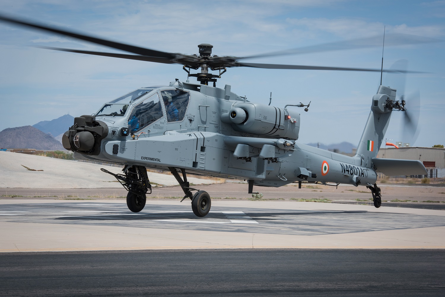
India’s own attack helicopter currently under development, the provisionally named Light Combat Helicopter, has an even higher service ceiling of 6500 m. It is also the world’s only attack helicopter to have successfully landed at an altitude of 4876 meters. And India’s indigenous utility helicopter, the HAL Dhruv, has a service ceiling of 6100 m.
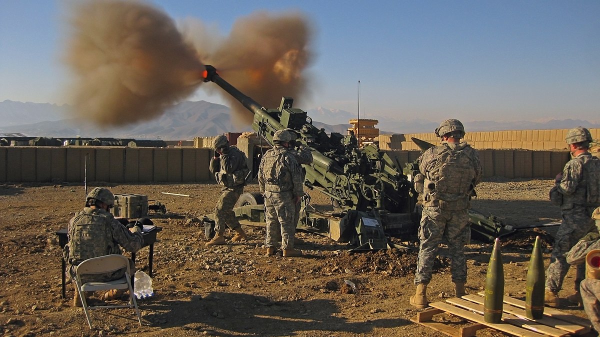
Another hardship that India faced during Kargil conflict was the inability to airlift the 155 mm Bofors howitzers, which had to be tediously hauled across the zigzag mountain routes. This experience is what led India to buy the M777 light howitzers from the US, along with the CH-47 Chinooks with a service ceiling of 6100 m, that would airlift the M777s to high altitude warzones like Kargil.
Another useful helicopter used by India in this region is the SA 315B Lama. It is a helicopter built from the scratch for high altitude operations. While as per Wikipedia its service ceiling is 5400 m, this is misleading. Because during user trials in the Karakoram mountains of India in 1969, the helicopter easily performed operations at an altitude of 6858 m, and on 21 June 1972, it established a world record by reaching an altitude of 12442 m, a record that’s still unbroken by any other helicopter. With that said, however, Lama is now getting old and is also prone to crashes. India eventually plans to replace it with the indigenous Light Utility Helicopter that’s supposed to have a service ceiling of 6500 m.
Mountains Prefer A Different Breed Of Tanks
Tank is one of the most conspicuous and familiar sights of modern warfare. But its no secret that tanks are mainly beasts of the plains. They have a hard time operating in the mountains due to the undulating terrain, steep slopes and narrow paths with little room to manoeuvre. There are light tanks, however, that can not just operate in the mountains but can turn the tide of a battle. One such tank is the M5A1 Stuart. Designed as a light tank by the United States during World War 2, this is the smaller, less well known cousin of the famous M4 Sherman.
A tank’s design needs to strike a balance between three qualities- speed, armor and firepower. These qualities are mutually antagonistic. More armor will increase weight, reducing speed and ammunition carrying capacity. More ammunition needed to increase firepower will impose similar weight restrictions on armor and compromise speed. Which of these qualities will be preferred over the other depends on the purpose the tank is being designed for. Being a light tank, the Stuart was supposed to be as fast and quite as possible. So, it sacrificed a lot of armor and firepower to minimize its weight. Consequently, in most theaters of World War 2, Stuarts mostly played second fiddle to Shermans, which were the front line tanks of the US forces.
In the mountains, however, Stuart easily outperformed heavier tanks. This was one of the reasons why the Soviets used much of the Stuarts supplied to them on lend lease in the fighting against Germans in the Ural mountains. After the end of World War 2, a large number of surplus Shermans and Stuarts ended up with the Indian army. And here, the Stuart would once again demonstrate its impressive capabilities in the mountains.
Shortly after India and Pakistan became independent countries in 1947, Pakistan invaded the Kingdom of Kashmir. In response, the King of Kashmir Maharaja Hari Singh decided to merge his kingdom with India and signed the instrument of accession. Following this, India entered the war and began pushing the Pakistani forces back. One of the theaters in the war was the Ladakh region, where Indian forces had to wrest Kargil from Pakistani forces.
Due to the altitude and terrain of this region, Pakistani forces did not expect the presence of any armor on the Indian side, and had not deployed any armor of their own either. So the sight of Stuarts came as a complete shock to them. Indians had transported the Stuarts in partially dismantled condition along mule paths from Srinagar all the way to Ladakh. Their light weight and small size had allowed them to traverse narrow paths, steep slopes and fragile bridges that no heavy tank could. When Stuarts arrived at the site of action, the unarmored Pakistani forces were easy pickings.
While the Stuarts have now been retired, the need for light tanks still persists in this part of the world. China has been developing the Xinquingtan or ZTQ light tank for operations in the Himalayas. ZTQ weighs between 33 and 36 tons- light enough to be airdropped by parachute. By comparison, modern western and Russian main battle tanks weigh between 50 and 70 tons. India had attempted to develop a light tank based on the BMP armored vehicle chassis back in 1980s. But that attempt didn’t go well and the tank never entered service. Now, India is once again embarking on a program to develop an all new light tank in response to the Chinese ZTQ.

Life Is Tough Up There
This one is obvious. No one would expect things to be easy at such high altitudes. But even within the Himalayas, the region where nature has turned out to be the deadliest is the Siachen glacier. This glacier is situated at the tri-junction of India, China and Pakistan occupied Kashmir/Ladakh, which makes it strategically important.
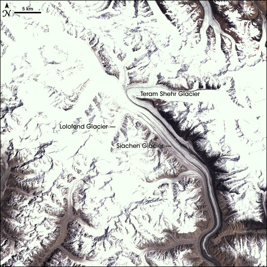
Pakistan has been interested in wresting control of it for an additional reason- it is one of the glaciers that feed the Indus river, the lifeline of Pakistan. The contest over the control of the glacier resulted in Pakistan secretly preparing to occupy it in 1980s. This plan however, was discovered by India, which launched Operation Meghdoot in 1984, occupying the entire glacier before the Pakistani forces could. Since than, the glacier has been under Indian control. But operation meghdoot resulted in what’s known as siachen conflict, consisting of a series of minor border clashes until a ceasefire was signed in 2003.
Over the years, however, it has emerged that a far deadlier entity, killing both Indian and Pakistani soldiers alike, is nature. In fact, far more soldiers on both sides have died since the 80s from weather and geography related factors than from actual combat. These factors include death by hypothermia, falling into ice crevices in the glacier, and avalanches. On 3 February 2016, an avalanche hit an Indian military instillation in Siachen, killing 10 soldiers.
This underscores the fact that deployment of troops in a region like Siachen is an extremely costly endeavor for both India and Pakistan, which is why both sides are in talks to hammer out a peace deal which could see withdrawal of troops from both sides, saving money as well as soldiers lives. The lack of faith between the two countries, however, has so far prevented that from happening. Meanwhile, the soldiers on both sides have to live in the conditions shown in the video below.
Conclusion
This is a region characterized by staggeringly high mountains, extreme cold and a history of warfare. The challenges it presents as a battlefield are very unique and have shaped the decisions of India, China and Pakistan concerning the development their military strategy, tactics and hardware. It also constantly reminds all sides that no matter how technologically sophisticated and militarily powerful they are, they don’t even come close to the power and sheer destructive potential of mother nature. You can read more about the mountain warfare tactics used in the Himalayas here.
Hopefully, as the countries occupying this region progress economically, they will enjoy improved mutual relationships that will reduce the strain on the foot soldiers on all sides, who have to sustain arduous situations every day they are stationed there.
